Tuesday, April 20, 2021

Petawawa Minus Rapids/Alpine Petawawa (Stacks Rapids)

From the 'Is it worth it?' files, before the latest pandemic lockdown, a couple of us took the opportunity one day to go explore a section of the Petawawa that I'd heard about from some of the old guard river veterans in the area, and also many canoe trippers, as it's along a well known canoe route, as is made evident by the world class campsites we passed while exploring. With the gauge reading about 130 cms, we took our chances and headed up.

There are two choices to get up there, you head up from Brent (Ontario), on the North side of Crater Lake (be sure to stop and check out the Brent Crater overlook...particularly if you can time it with the sunset!), paddle across the Lake to the river mouth, and paddle and hike (using obvious canoe portage routes) your way upstream to a bridge. This should take about two hours and be around 3.5 km of walking plus the paddling. I recommend this option. You will of course need an Algonquin Provincial Park pass.

The other option is to head up Bissett Creek Road to the same put-in bridge just downstream of Narrowbag Lake, which we haven't ever actually tried, but according to Google would take 2.5 hours one-way from the takeout to accomplish. Varying reports of quality on Bissett Creek Road.

This is a very odd section, I can see why it's not regularly done, though I must say it gets a 10/10 for Freyventure goodness, and if everything were runnable at once, it would also get high marks for overall quality. The problem is that there are too many log choked or just plain dirty rapids with sieve-y rocks, shallow landings, you can tell that everything on this section has relatively recent remnants of logging management (the whole run feels like one big log flume), and levels for many rapids don't line up at once.

Despite all the misgivings, this run still exceeded my low expectations in overall character alone, and the scenery is downright amazing!

Take your chances with this one...or not.

Looking downstream from the put-in right side.
Left side of the put-in island.

Man were we surprised to look upstream and see the bridge, we had no clue the portage would go all the way up there! Narrowbag Lake would be a bit more upstream of here.

Nate cooling off after she decent uphill hiking that made us think there was definitely some gradient going on...especially when we didn't come back down much.

After 1-3 fun little flushy pool drop rapids came this sneaky, sticky hole that caused an unfortunate swim for one of our intrepid group. It had a good boof, but beware the tractor-beam. Billy enjoying some nature vibes.

Swiftwater from that hole leads over this horizon line, luckily we were able to get everything back prior...

...because this horrible log choked mess that lands on a rock shelf followed, too bad, from up top this looked capital quality.

After 1-3 more pool drop rapids that all go with various degrees of quality (and marginal eddies in their lead-ins) comes a longer series that finished with a man-made rock wall going down the left side of the river. At our level it had a couple stout holes, but all would have gone with varying levels of difficulty, for the pictured hole a bit lower water would be preferred for this guy. Following this is a longer class II-III stretch of continuous flow out into a lake, which heads towards the big slide that you might notice on the hike up.

Evidence of an old wooden log slide and log handling at the big slide.

Old bolts at the bottom of the slide.

Evidence of the old log slide, you can google photos from the 70's where it's still intact in old canoe trip reports.

The slide, it looks like there is a line with potential down the right, but most of it looks to land on rocks, it might be better with more water, I'd also like to see how far the rock shelf extends on the right at extreme low flows to know if the line is good. Kindof reminiscent of Twin Falls on the Grass in NY, but less clean. Has anyone run this?

Following another lake is this beauty boof, with a messy runout shortly following. There are two marginal eddies on the right to catch after the falls if you want to fire this up and avoid the two manky channels below. I have a feeling we had an ideal water level for the falls, but more water might also clean up the mank below, while spicing up the falls.

Nate dropping the falls, managed to catch the first eddy alright.

Billy on the falls, marginal results followed.

Looking up at the falls from below the two channels of ugliness. Horrible split rocks, undercuts...and a marginal line at this level down the left channel.

Following the mank is a long continuous stretch of class IV with some stout holes at our level and some mostly out of play wood, eventually transforming to class II-III into the lake after about 60m.

Looking upstream from Crater Lake.

This is a nice lake. Looks like the railbed along the North and through Brent is the same one that follows the Upper Petawawa, just many km upstream of there.


Monday, April 5, 2021

Moores Creek

Ontario creeking is a fervent animal. Most 'creeks' in this province are larger volume, have at least 500m of flatwater between rapids, have short...but often sweet rapids, and can run between 2 weeks and 3 months in the Spring depending on snowpack and how goes the melt.

Moores bucks some of these trends, and for a brief moment, you'll feel as if you're back in Cali or parts of the PNW. It's a mission to get to, involving a notably uphill drive on a logging road up river right from the  marked takeout bridge just south of Madawaska over the reservoir. In all likelihood when this is running you'll probably run into a muddy, partially snow-covered road like we did. We also had a large log that the trucks could make it over, but might not work even for a seasoned 4WD car with clearance.

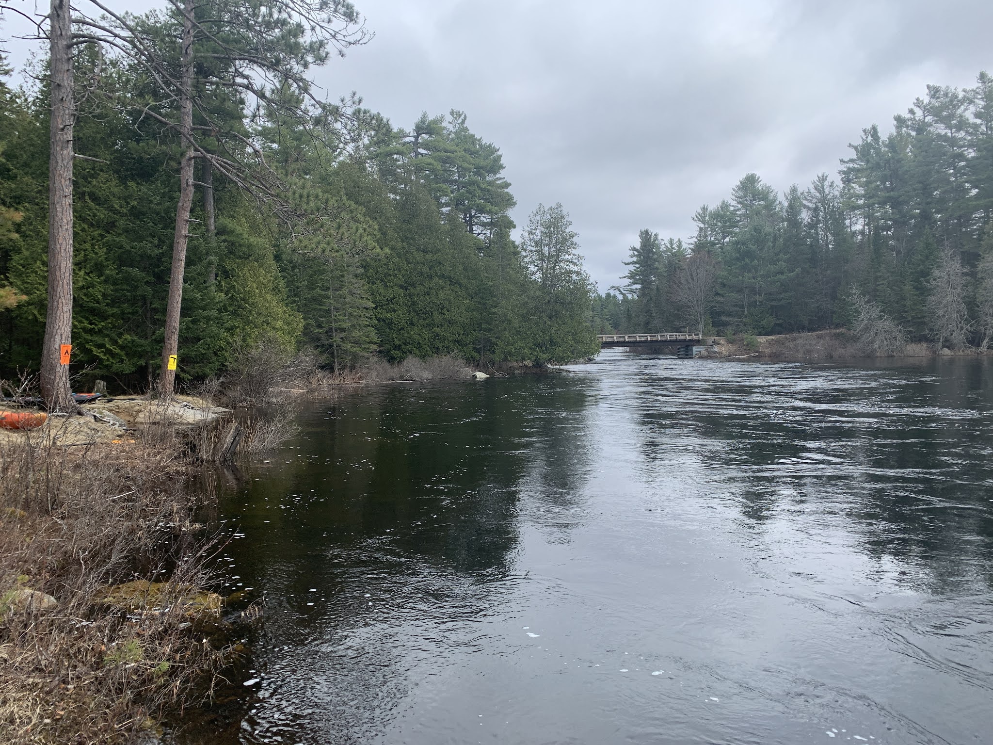
Staying on the main road and guiding yourself with Caltopo, you'll eventually find yourself on the South side of the small lake to the Southeast of Moore's, where the road gets closest, and there's a small clearing where ATVers no doubt spend some time. Follow the obvious trail over to the small lake, paddle or walk across/around to another obvious trail through to Moore's Lake, hopefully the edge is mostly clear of ice so that you can paddle around to the right, eventually ending up at the mouth of the river where there is a low bridge. When we went 5 April 2021 there was also a river-wide log causing a portage.

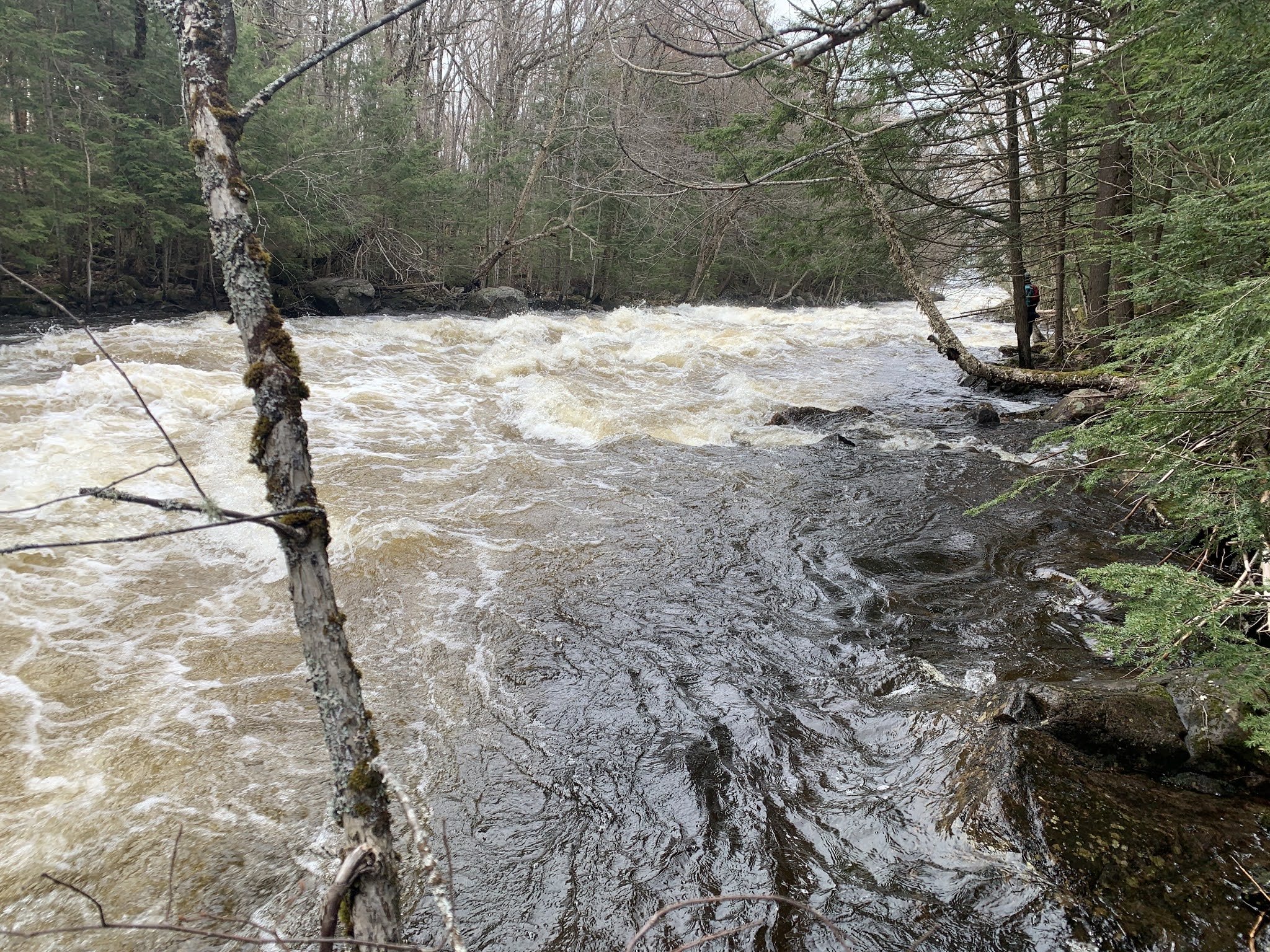
Following this is a smorgasbord of longer and steeper than usual Ontario style rapids split up by flatwater. You would easily be able to scout or walk everything in here, and I recommend following someone who knows it so that you get on some things blind, as long as the wood situation is known.

In total there are about 5 major rapids from the lake starting with a ledgy mini-canyon, drop and slide, big slide with multiple options or lines and a giant kicker ramp at the bottom, a rampy trough drop and finishing with Moores Falls, which doesn't look ideally runnable but has a nice slidey runout.

Verdict is, get here when it's running, because it might not be for long in any given year, though there is lots of ice to melt still and rain would definitely have some effect, the creeking doesn't get much better in this province!

Access notes: I’ve posted the Caltopo map below the pictures with the put in and takeout marked. DO NOT take Dunn’s road, you will have a bad day with private road issues. Take the logging roads on river right to access.

Hugh airing the rooster

Road maintenance crew

Such a nice day, and no bugs!

Ryan coming down the last stretch

Hugh at the bottom of the middle stretch

Me...trying to line up the rooster. Photo by Ryan O’Connor.

Graham sliding the falls runout

Again...

...and again, with a twist!

....and again! Why not?!


You can also see a short video here:

https://www.facebook.com/517119803/videos/10159274200599804/