Upper Chehalis has long been on the radar, with rumours of massive logjams, epic portages over canyons, triple sets of waterfalls, 30 footers, wood everywhere, people getting hurt and only a broken half remembered account of a descent by a few people some 10 ish years back it's just being begged to have someone give it a go at some point. Finally others keen on the idea joined and we got 3 of us to just finally head in there and see what could be found.
With there being slides all over the run that you can see clearly on google earth as well as a massive slide that came down at the north end of the lake a few years back there was and always is definite potential for wood trouble in here, luckily on this day wood would not be a factor except for a singular large logjam.
Upper Chehalis can be divided into two distinct sections, a 3 km section
out of the lake down to a bridge over the river and a 10 km section
from the bridge down to the confluence with Statu (if you do this, I
advise combining it with the regular run as the hike out up the hike in
to the regular Chehalis run is pretty brutal). Both sections are worthy
of repeat and we all agreed we'd be going back for return trips. The
level on the staff gauge was 9.63.
The 'lake to bridge' we all
agreed could be called classic, though short it is also extremely
scenic. It starts off with a km long class 2-3 paddle out of the lake
mouth to an obvious pinch and horizon line marking an optional class 5
rapid. Eddy out on the river left gravel bar 100 feet or so upstream of
the pinch to take a look from river left. The vantage point is
magnificent from here with a big room and pool below and a large
partially connected tall island reminiscent of what you'd see at the Bay
of Fundy, this has a small cave at the bottom to be mindful of if
you're running the drop. If it doesn't speak to you head across to river
right from the gravel bar and hike up into the ridge and lower your
boat down a steep crack that comes out in behind the 'island'. Ash fired up a great line on this rapid.
After
the first drop the upper continues through 2 km of pool drop class
3+/4-, a half step up on the classic Chehalis run, with the last drop
where the bridge is visible being a bit harder than the rest and ending
in a larger river wide hole, you'll see this drop from the bridge on the
drive up, at lower levels the lead in contains some rocks and
pourovers, at higher levels it is a series of large pourovers leading
into it. There is a massive pool just after the bridge though.
To get to the lake you take an immediate uphill left
after the bridge and stay left as the road forks, eventually leading to a
campground at the south end of Chehalis Lake.
 |
| This is the view looking upstream of the bridge at higher water (9.75), you can see the large ledgehole |
 |
| Taking off onto Chehalis Lake |
 |
| Higher water view of Holy Roller looking downstream |
 |
| The entrance to Holy Roller at higher water |
 |
| Exit of Holy Roller at higher water, which actually greens out the middle and makes it more friendly |
 |
| Exit of Holy Roller at lower water, much steeper hole you need to run hard left, there is also a barely visible cave up against the downstream wall. Photo Scott McBride |
 |
| Holy Roller from downstream |
 |
| Looking downstream after Holy Roller, the semi-island is on the left |
 |
| Scott checking out a standard rapid in the immediate canyon below Holy Roller |
 |
| Ash looking upstream at the first canyon. Photo Scott McBride |
 |
| Scott and Ash running the rapid upstream of the bridge |
The 'bridge to Statlu' section is a bit more of a story, it's about 10 km long and starts off at the bridge with 5 km of class 2-3 similar to the lower part of Chehalis, maybe some class 3/4- that is a half step up before the river narrows up through a few bends and the canyon walls get taller. This is when you'll find yourself in the crux canyon of the run.
We got out to scout at an eddy on river left only to find somewhat of a horizon line leading down into a left turn dogleg in the river, at this point the river narrows and steepens as well, we needed to get to an eddy on river right to scout the rest of this drop. After watching Ash have a messy line through the entrance where the river funnels through a narrow slot, and me get disconnected from my boat at the same spot only to get bagged out before the drop, Scott decided to portage, regardless it was a difficult ferry across to the eddy with lots of push that he barely pulled off with a roll. I suggest being confident in making this move if you're going in here, it's a tough move with lots of water going into the narrow area, and not one to be underestimated.
The class V rapid following goes for sure, however with the situation at hand and not knowing how much more we'd have to deal with we decided to save it for another day. At the bottom there was a bit more class 4 into a bend with an eddy on river left that I had to get bagged across above another horizon line.
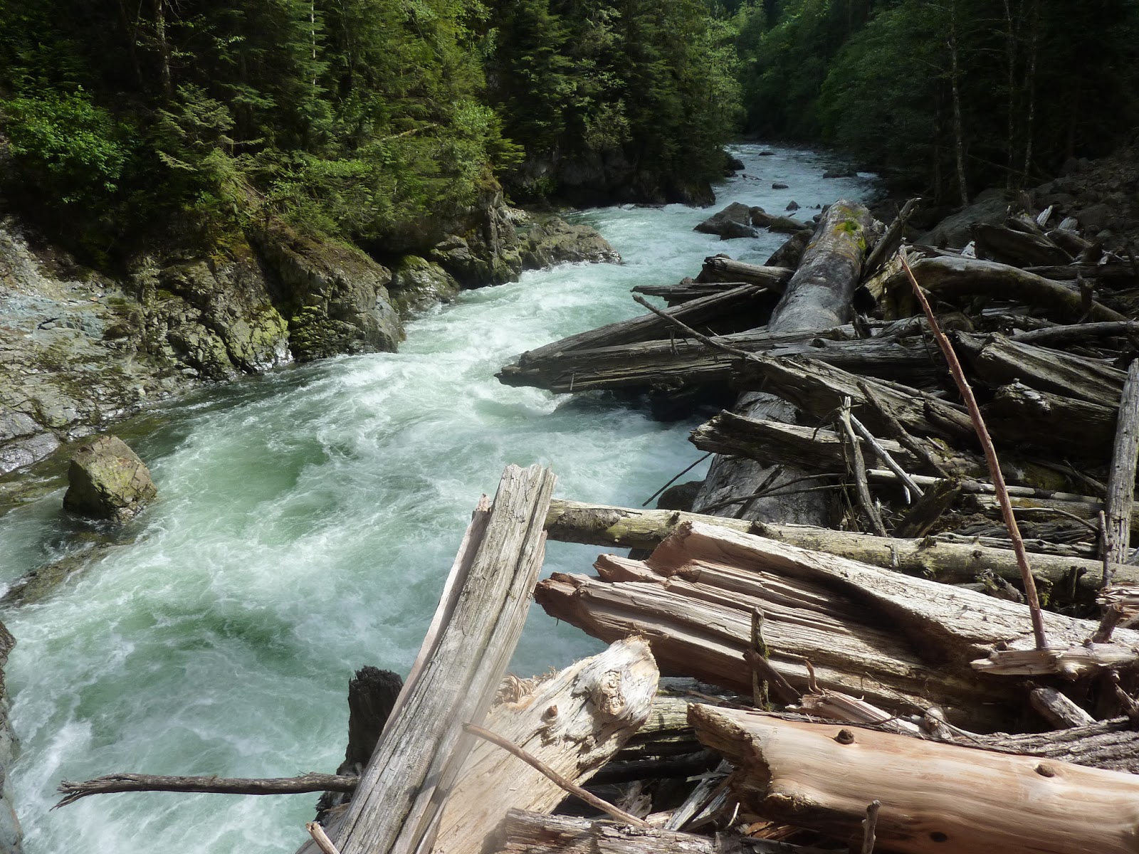
The end of the canyon was an awesome 10-12 foot boof before it mellowed out similar to the first half for the next km or so then came around the corner into a riverwide logjam about 15 feet high. Luckily the logjam had all my gear resting on it! We quickly Z-dragged my boat out, and recovered my camerabag and paddle right there....thanks logjam!
The logjam was a surprisingly easy portage as well as the only mandatory one in the entire strech of Chehalis river below the lake and looks to cover a decent rapid unfortunately, who knows if it's from the slide at the north of the lake or the many slides you boat by on this run..after the logjam is a powerful pourover which subsequently sent me out of my boat again after a good fight no less than a minute after I'd been back in it.
The last couple km down to Statlu is similar to what you find between the Chehalis hike in and Statlu confluence, we unfortunately decided to take the hike in trail out not knowing how long everything would take us and it was a pretty uphill hike, reminiscent of Cameron Creek on Vancouver Island. If you're going to take this out, I recommend marking the takeout for it as every bend looks the same at this point on the river. There are also some amazing waterfalls coming in along the banks of this run as well.
This is a great stretch of river if you want to deal with the crux canyon, there may be a way to portage the canyon along the top, we didn't really check. If you don't want to deal with it and want an easier to deal with run I recommend from the lake to the bridge for sure. It'd be a great day to combine it all with the classic Chehalis run for a good 20+ km day of boating!
 |
| Looking down into the top of Gnarly Canyon, the entrance drop that gave us fits is to my right (not visible) |
 |
| The exit of Gnarly Canyon, a big hole on the left, there are a few undercuts and seives in this rapid as well. Photo Scott McBride |
 |
| Me waiting for a rope at the bottom of Gnarly Canyon and just above another horizon line. Photo Scott McBride |
 |
| ...the other horizon line turned out to be a nice 10ish foot boof, Chehalis Falls. Photo Scott McBride |
 |
| Very stoked to get my boat and gear back shortly downstream at the massive logjam! Photo Scott McBride |
 |
| Looking downstream on the logjam. Photo Scott McBride |
 |
| Surf's up! Photo Scott McBride |